The Cellar: a friendly neighborhood coffee shop, with no coffee and no shop. Established 1990.
- Diaphone Jim
- Not Ignoring You.
 Offline
 - Registered: 10/13/2020
- Posts: 1,420
Mountains
We had a couple of ongoing threads about some of the scary mountains of the world. This is a continuation.
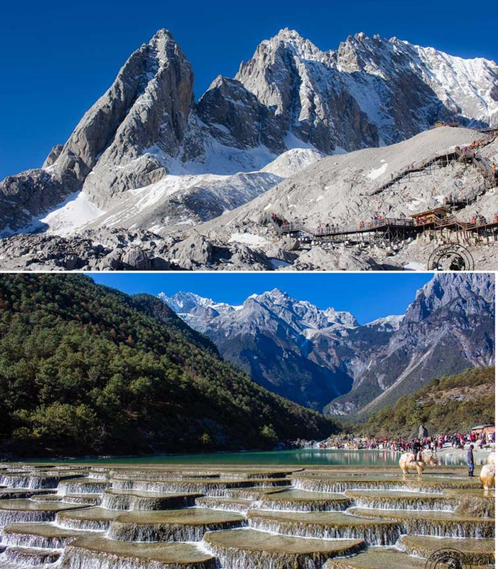
Today's Astronomy Picture of the Day features Mars, a meteor and one of the amazing places China seems to have in surplus.
[url] [/url]
The pics at the bottom are great.
I had problems with links and am still working on actual photos, so this maybe fubar.
- griff
- A Magical Woodland Creature
 Offline
 - Registered: 10/13/2020
- Posts: 3,139
Re: Mountains
Wow! What a beautiful shot.
If you would only recognize that life is hard, things would be so much easier for you. - Louis Brandeis
- bbro
- Member
 Offline
 - Registered: 10/15/2020
- Posts: 462
Re: Mountains
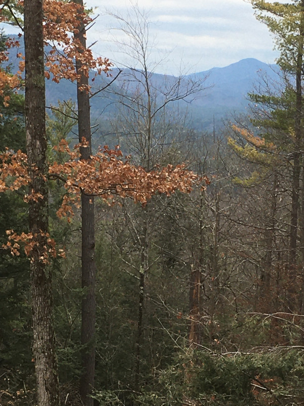
I miss the mountains. I didn't make it to Asheville NC last year nor (obviously) this year. I am hoping to go back next year
- griff
- A Magical Woodland Creature
 Offline
 - Registered: 10/13/2020
- Posts: 3,139
Re: Mountains
I found out how pretty that is last year. Very nice.
If you would only recognize that life is hard, things would be so much easier for you. - Louis Brandeis
- griff
- A Magical Woodland Creature
 Offline
 - Registered: 10/13/2020
- Posts: 3,139
Re: Mountains
If you would only recognize that life is hard, things would be so much easier for you. - Louis Brandeis
- xoxoxoBruce
- The Future is Unwritten
 Offline
 - Registered: 10/15/2020
- Posts: 4,355
Re: Mountains
Somebody say mountains?
Freedom is just another word for nothin' left to lose.
- meghanswift
- Member
 Offline
 - Registered: 10/19/2021
- Posts: 12
Re: Mountains
guess the world's 2nd highest mountain?
- xoxoxoBruce
- The Future is Unwritten
 Offline
 - Registered: 10/15/2020
- Posts: 4,355
Re: Mountains
It's supposed to be K2, but the height is measured from sea level. The Earth is not perfectly round so sea level varies too.
Mauna Kea in Hawaii is only 14,000 ft above sea level, but it's near 20,000 ft below sea level making it the tallest mountain on earth.
I guess as the oceans rise somebody has to change all the measurements.
Freedom is just another word for nothin' left to lose.
- BigV
- Hold my smoky malt beverage and watch this
 Offline
 - From: the upper left corner
- Registered: 10/13/2020
- Posts: 1,390
Re: Mountains
These aren't mountains, but they're made of the same stuff, frozen magma. Much of eastern Washington is covered in successive layers of basalt. It's a big LIP (large igneous province). As the supercaldera currently known as Yellowstone welled up and overflowed with excess magma, it poured out through cracks in the crust called fissures. The blade-shaped towers here are known as fissures, but they're really just the more solid remains of the cracks in the crust through which the magma flowed, back (way back) in the day. The surrounding surface material, softer than basalt, eroded away and left these remnants. These are from a road trip we took a few weeks ago to the southeaster corner of the state near the Idaho Oregon Washington border.
Be Just And Fear Not
- griff
- A Magical Woodland Creature
 Offline
 - Registered: 10/13/2020
- Posts: 3,139
Re: Mountains
How cool are those? I'll answer that, extremely cool. What's the surface texture?
If you would only recognize that life is hard, things would be so much easier for you. - Louis Brandeis
- Diaphone Jim
- Not Ignoring You.
 Offline
 - Registered: 10/13/2020
- Posts: 1,420
Re: Mountains
I think the big one is a petrified owl.
- •
- TheNeverWas
- Member
 Offline
 - Registered: 6/30/2021
- Posts: 1,384
Re: Mountains
xoxoxoBruce wrote:
Mauna Kea in Hawaii is only 14,000 ft above sea level, but it's near 20,000 ft below sea level making it the tallest mountain on earth.
My penis measurements work the same way. Base to tip, I'm barely average. But, if I measure from sea level, starting at my shoulder blades, and going around my slack-hanging sack, to the tip, I'm yuge.
Yuge, I tells ya.
And I come so fast that a Tesla don't even know anything happened, till that slick spot where a grille should be gets stickier than a Tesla-owner's soul patch.
These statements have not been evaluated by the FDA, EPA, FBI, DEA, CDC, or FDIC. These statements are not intended to diagnose, cause, treat, cure, or prevent any disease. If you feel you have been harmed/offended by, or, disagree with any of the above statements or images, please feel free to fuck right off.
- TheNeverWas
- Member
 Offline
 - Registered: 6/30/2021
- Posts: 1,384
Re: Mountains
griff wrote:
What's the surface texture?
Looks to be about the same as my prostate's...
These statements have not been evaluated by the FDA, EPA, FBI, DEA, CDC, or FDIC. These statements are not intended to diagnose, cause, treat, cure, or prevent any disease. If you feel you have been harmed/offended by, or, disagree with any of the above statements or images, please feel free to fuck right off.
- xoxoxoBruce
- The Future is Unwritten
 Offline
 - Registered: 10/15/2020
- Posts: 4,355
Re: Mountains
If you're into mountains and the little villages up there, scroll down this thread on twitter. Just one after another of 10 to 30 second long animated GIFs of the incredible scenery. Guaranteed or your money cheerfully refunded.
Freedom is just another word for nothin' left to lose.
- Diaphone Jim
- Not Ignoring You.
 Offline
 - Registered: 10/13/2020
- Posts: 1,420
Re: Mountains
Thanks Bruce, I tried to put Christmas trees on my cows' heads and they stomped me near to death.
- •
- xoxoxoBruce
- The Future is Unwritten
 Offline
 - Registered: 10/15/2020
- Posts: 4,355
Re: Mountains
Ah mistake, got to start them as calves.
Freedom is just another word for nothin' left to lose.
- Diaphone Jim
- Not Ignoring You.
 Offline
 - Registered: 10/13/2020
- Posts: 1,420
Re: Mountains
A variant of the Milo of Croton story, which has some other interesting aspects.
Stay tuned.
- •
- xoxoxoBruce
- The Future is Unwritten
 Offline
 - Registered: 10/15/2020
- Posts: 4,355
Re: Mountains
South America has mountains too.
This map of South America from the dawn of the 20th century looks like a topographical map. It’s actually a geological map. All those color keys separated into the land , the continental shelf by age, Jurassic, Triassic, etc. Then the third larger group is the type of rock.
This map, like most maps of the era exaggerates the heights of the mountains. In this case in order to fit all the information in. However it’s easy to see where and why the rainforests/jungles are.
If you click on the picture twice it will embiggen... and you won't be in Kansas anymore.
Freedom is just another word for nothin' left to lose.
- xoxoxoBruce
- The Future is Unwritten
 Offline
 - Registered: 10/15/2020
- Posts: 4,355
Re: Mountains
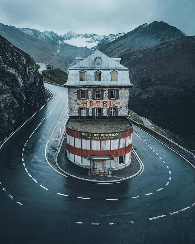
It's a shame this Swiss hotel is now closed...
Would have been fun to have dinner while watching distracted tourists fail to negotiate the turn and plunge to their deaths.
Last edited by xoxoxoBruce (1/14/2022 9:09 pm)
Freedom is just another word for nothin' left to lose.
- TheNeverWas
- Member
 Offline
 - Registered: 6/30/2021
- Posts: 1,384
Re: Mountains
All those Saabs drifting that corner woulda kept ya awake, anyway...
These statements have not been evaluated by the FDA, EPA, FBI, DEA, CDC, or FDIC. These statements are not intended to diagnose, cause, treat, cure, or prevent any disease. If you feel you have been harmed/offended by, or, disagree with any of the above statements or images, please feel free to fuck right off.
- TheNeverWas
- Member
 Offline
 - Registered: 6/30/2021
- Posts: 1,384
Re: Mountains
Heh, drifting Saabs.
These statements have not been evaluated by the FDA, EPA, FBI, DEA, CDC, or FDIC. These statements are not intended to diagnose, cause, treat, cure, or prevent any disease. If you feel you have been harmed/offended by, or, disagree with any of the above statements or images, please feel free to fuck right off.
- BigV
- Hold my smoky malt beverage and watch this
 Offline
 - From: the upper left corner
- Registered: 10/13/2020
- Posts: 1,390
Re: Mountains
xoxoxoBruce wrote:
South America has mountains too.
This map of South America from the dawn of the 20th century looks like a topographical map. It’s actually a geological map. All those color keys separated into the land , the continental shelf by age, Jurassic, Triassic, etc. Then the third larger group is the type of rock.
This map, like most maps of the era exaggerates the heights of the mountains. In this case in order to fit all the information in. However it’s easy to see where and why the rainforests/jungles are.
If you click on the picture twice it will embiggen... and you won't be in Kansas anymore.
Like it?
Buy it.
Be Just And Fear Not
- griff
- A Magical Woodland Creature
 Offline
 - Registered: 10/13/2020
- Posts: 3,139
Re: Mountains
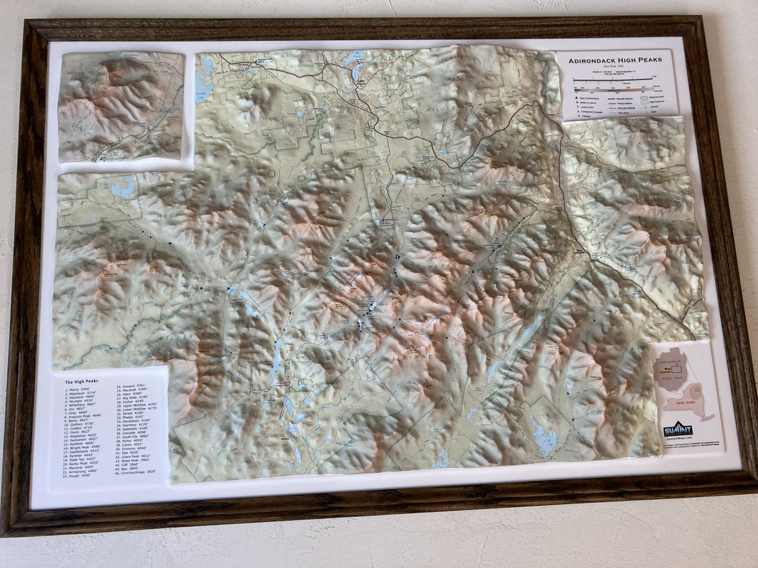
I have one of these for the High Peaks of the Adirondacks. It has a lot of trails mapped out and gives a good sense of the terrain you'd cross.
Last edited by griff (1/16/2022 10:50 am)
If you would only recognize that life is hard, things would be so much easier for you. - Louis Brandeis
 1
1 
